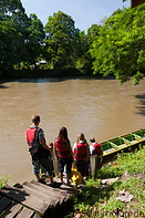
The Ulu Temburong National Park (formerly known as the Batu Apoi Forest Reserve) was opened as the first national park in Brunei in 1991. It occupies an area of 500 sq. km and is located in the Temburong district in the east of Brunei. Of its 500 sq. km approx. 1 sq km is available for tourists to visit. The park extends from lowland areas to high mountain areas.
Due to its oil wealth Brunei never had to exploit its rainforests, therefore the park contains beautiful primary rainforest in an excellent preservation status and is full of tall, old trees. Spotting wildlife other than small animals and invertebrates is difficult however, because one would have to venture deep into the forest and because according to a park guide at the park borders there are plantations which attract animals because of the food grown there.
The park is only accessible by boat. From Bandar Seri Begawan, the capital of Brunei, visitors take one of the high-speed water taxis (travelling up to 80-90 km/h) to the town of Bangar in the Temburong district. From there it's a 30 min. trip by bus to Batang Duri, where visitors board the longboats which bring them up the Temburong river to the Ulu Ulu resort in the park, which is both a hotel and the park headquarter. Around the park HQ there is a network of wooden boardwalks which allow to explore the surrounding forest without having to touch the ground.
A path in the rainforest leads to the basis of the canopy walkway. This consists of a number of 60m high aluminium towers which extend above the treetops and are interconnected by bridges. The canopy walkway is the highlight of each visit to the Ulu Temburong national park, because it offers great views of the rainforest.

|

|
|
|
22 miscellaneous photos of the Ulu Temburong national park in Brunei
|
17 photos and panoramic views of the rainforest of the Ulu Temburong national park
|
Gallery with all images
|
Page viewed 14935 times since 25.03.11
©Copyright Alfred Molon
