
Si Phan Don (4000 islands)
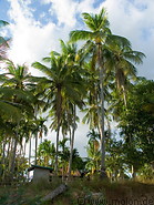
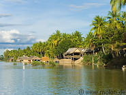
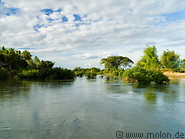
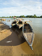
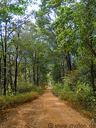
In the extreme south of Laos the Mekong river breaks down into a miriad of arms and channels, which surround countless islands and islets. This region is called "Si Phan Don", which in Lao means "4000 islands". In the area there is a small population of Irrawaddy (river) dolphins. The entire area is very scenic and attracts a large number of tourists, but navigation by ships becomes impossible, especially because the river passes through the Khon Phapheng waterfalls. This is why the French built a railway to bypass this region for the transportation of goods.
The major islands, the ones with the best tourist infrastructure and which attract most of the tourists, are Don Khong (the largest and most developed) and the Don Khon and Don Det islands further to the south, which are less developed and (in 2005) still had no electricity.
The major islands, the ones with the best tourist infrastructure and which attract most of the tourists, are Don Khong (the largest and most developed) and the Don Khon and Don Det islands further to the south, which are less developed and (in 2005) still had no electricity.
|
|

|
|
|
|
7 photos of Don Det island in the south of Laos at the border to Cambodia
|
20 photos of Don Khon, a small island close to the border to Cambodia
|
24 photos of Don Khong, a large island in the Mekong river, the largest in the 4000 islands region
|
26 photos of the Mekong river in the 4000 islands region
|
4 photos of Ban Nakasang, a small village where tourists take the boats to go to the islands
|
|
|
|
4 photos of Veunkham, a small village in the south of Laos
|
Gallery with all images
|
Related travelogues
|
Page viewed 58431 times since 03.08.2006
©Copyright Alfred Molon